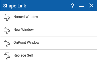
Shape Link toolbar
1. When the first Shape Link is created, a Shape Link toolbar is automatically created and displayed in the Tools menu of your OnPoint web-GIS application. Additional shape links are then added to the toolbar as they are created.
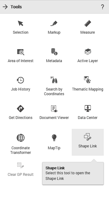
2. From the Tools menu, click on the Shape Link tool. The Shape Link window appears.
3. Click on the appropriate shape link and click on the map to open the configured shape link.
4. You can configure toolbar parameters or make Shape Link tools part of the Map Tools toolbar using the Tools/Commands node of the OnPoint Administration Console.