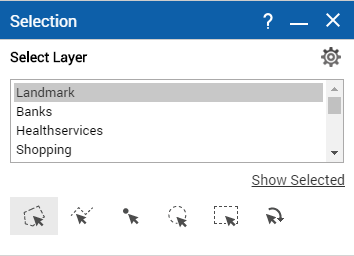
Selecting features on the map from multiple layers
If your site administrator has enabled this functionality, you have the option of selecting features from multiple layers or feature groups. You know this functionality exists if you see a list box on the Selection window.
1. To open the Tools pane, from the command bar, select

.
2. From the Tools pane, select Selection.
3. In the Selection Layer field, select the type of map feature you want to view. You can select features from multiple feature groups or layers by holding the CTRL key as you select.
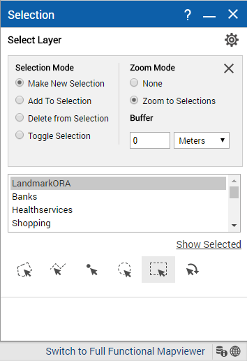
4. You can select the Options button

to set additional options for selecting features.
5. In the Selection Mode field, select the option that defines how items are added or removed from the list when you select features on the map. The options are the following:
• Make New Selection. This option creates a new selection group or replaces an existing group of the same type.
• Add To Selection. This option adds new selections to a group of the same type.
• Delete From Selection. This option removes items from an existing list.
• Toggle Selection. This option both adds new items to the list and removes previously selected items from the list.
6. In the Zoom Mode field, select either Zoom To Selections to have the map zoom in or out to show all the results or None to have the map remain at the current map scale.
7. In the Buffer fields, you can optionally enter a buffer area by the distance you specify around each selected item.
8. Select one of the following icons to either select a specific area or draw a shape on the map:
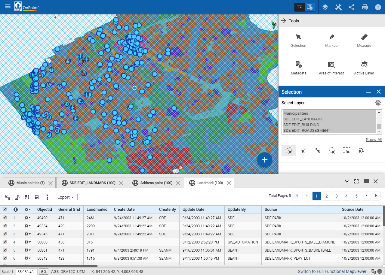
9. Use the tool to draw the required shape. All items of the selected type within that area display appear in the Results window in the list view.
• Figure 121 depicts the result in the Results window in the grid view, whereas the default view is the list view. Note that the grid view is not supported only on the mobile devices.
• In the Results window, you have icons that allow you to perform additional actions. See
Table 8 for descriptions.